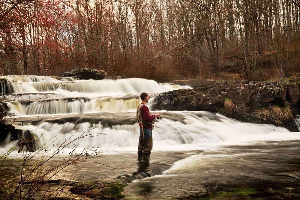
Explore Milford’s Natural Beauty
Want to get outside and enjoy what Milford is really famous for? Then here’s our top lists for waterfalls, hiking, state parks, and scenic drives to help you truly experience Milford and its surrounding areas’ natural beauty.
Waterfalls
Bushkill Falls
8 waterfalls, hiking trails, gift shops, food, family activities. Entry fee. 21 miles South on Rte. 209 from Milford. Right on Bushkill Falls Rd. (888) 287-4545 • www.visitbushkillfalls.com
Raymondskill Falls
Large falls, platforms and rugged stairs alongside, access to top and bottom. 2.5 miles South on Rte. 209 from Milford.
Dingmans Falls
Boardwalk through ravine bring visitor to two waterfalls. Handicapped friendly. Park Service staff on hand at gift shop for Park info. Road closed in winter (after first snow) but you can park at gate and walk approx. 1 mile. Travel 7.5 miles South on Rte. 209 – see sign on right.
Shohola Falls
Large Falls that you can get close to on State Game Land. Large lake for boating. Hiking trails. 11 miles from Milford on Rte 6 East. Several signs on left – one before and one after bridge overpass.
Tumbling Waters Falls at PEEC – Pocono Environmental Education Center
Numerous hiking trails (maps at front of building), waterfall, exhibits, events. 15 miles South on Rte. 209. Right on Briscoe Mountain Rd. • www.peec.org
Hiking
- Delaware Water Gap National Recreation Area (DEWA)
- (DEWA) McDade Trail
- Flat groomed trail for walking and biking – parallels Delaware River from Milford to Stroudsburg.
- Numerous access points along Rte. 209.
- (DEWA) Cliff Trail
- Spectacular views of the river valley from atop the Pocono Plateau.
- Access trailhead across from Raymondskill Falls lower parking lot.
National Park visitor services will be temporarily relocated to the Bushkill Meeting Center on Route 209 on weekdays (except federal holidays) from 8:30 a.m. to 4:30 p.m. for pass sales, visitor info, NPS passport stamps, and bookstore.
(570) 426–2452. Emergency # 800 543-4295 (HAWK)
State Parks
Lily Pond
Pristine large pond for boating and fishing. Picnic pavilion and restrooms. Several hiking trails at far end of pond – Huckleberry Trail (near parking area) and Foundation Trail (further along road beyond parking area).
Promised Land State Park
View maps here. Nearly 60 miles of hiking trails. Lakes for boating, picnic areas, museum, waterfall. Take Rte. 84W to Promised Land Exit # 26. Left on Rte. 390. Trail markers along this road. Maps and Info center 4.5 miles on right – Lower Lake Rd.
Scenic Driving Tours
Hawks Nest (N.Y. Rte. 97)
- Travel along the Upper Delaware River – great views of river and valley from Port Jervis NY to Hancock NY.
- Drive East on Broad St. (turns into Rte 209).
- Continue straight through Matamoras, over bridge, after underpass make left onto Pike St.
- At traffic light, make left. This turns into Rte 97.
- Suggestion: Rte. 97 to Roebling Bridge, Zane Grey Museum and Minisink Battleground.
Rte. 209
- Travel through the Delaware Water Gap National Rec. Area.
- Wooded plateau on one side (waterfalls), Delaware flats (McDade Trail) and river on the other on the other side, 25 miles from Milford to Stroudsburg.
Old Mine Rd
- One of the nations earliest roads.
- Pass through lush woods, old homesteads and cemeteries on the NJ side of the Delaware River in the Delaware Water Gap National Recreation Area and Worthington State Forest.
- Directions: Harford St. to Milford Bridge. First right on NJ side.
Come back often, keep exploring, and you too will fall in love with this little piece of paradise. Hope this helps.
Compiled by Marie Liu.
mliuart@yahoo.com
The Artery


